The GeEAUde partnership chair aims to develop digital tools that enable :
![]() To simulate the current and future hydrodynamic functioning of aquifers based on anthropogenic and climatic forcings,
To simulate the current and future hydrodynamic functioning of aquifers based on anthropogenic and climatic forcings,
![]() Integrate modeling and monitoring tools into a dynamic forecasting platform that provides managers with real-time, informed decision support.
Integrate modeling and monitoring tools into a dynamic forecasting platform that provides managers with real-time, informed decision support.
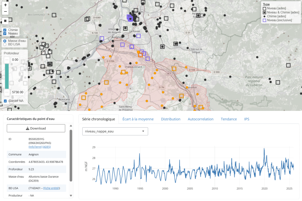
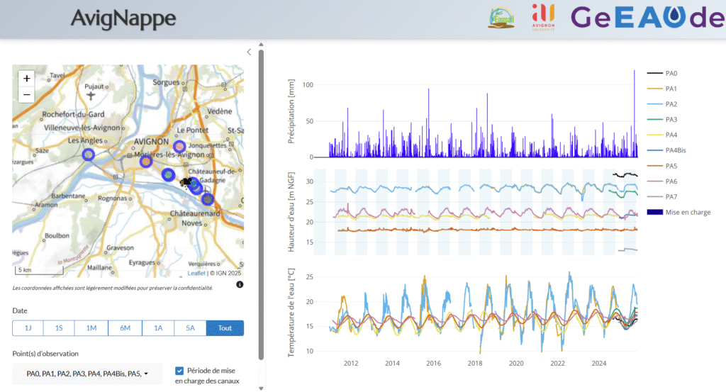
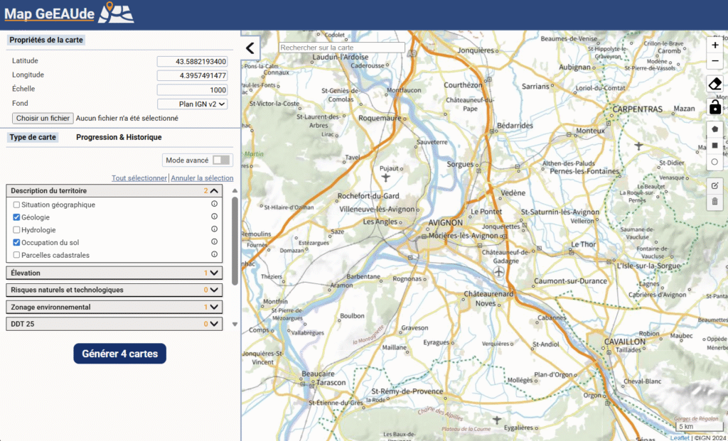
The development of such tools began as soon as the GeEAUde partnership chair was launched, with the aim of facilitating access to and use of hydrogeological and, more broadly, environmental data.